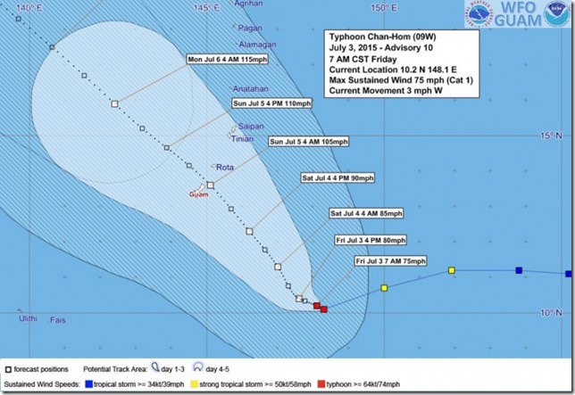
From the Pacific News Center…
According to the 7am public advisory from NWS typhoon Chan-Hom has maximum sustained winds of 75 miles per hour and it is currently on a track that would take it North of the island of Guam. However NWS forecasters warn that this forecast track could easily change as it already has over the past few days. NWS forecasters have told PNC that exact track and intensity of Chan-Hom is difficult to predict because of other systems in the area that have all been interacting with Chan-Hom.
Governor Calvo placed Guam in Condition of Readiness 3 (COR3) yesterday (Thurs). A typhoon watch also remains in effect for Guam Rota Tinian and Saipan which means that any one of these islands could possibly feel typhoon strength winds within 48 hours.
Chan-Hom is moving West at 3 miles per hour which is a significant decrease from it's previous speed of 23 miles per hour. It Is expected to continue Westward through today (Fri.). It is also expected to make a sharp turn Northwest tonight on a track that would bring it through the Marianas Saturday night.

No comments:
Post a Comment